On or near this date, tall cliffs with a ‘reddish color’ appear on the Illinois side of the Ohio. One of them is present Tower Rock. Below Elizabethtown and Hurricane Island, sandbars and thick fogs continue to challenge the navigators.[1]Neither captain appears to be keeping a journal as the expedition travels between Louisville and Fort Massac and their precise location on this date is unknown.
Reddish Cliffs
[O]n the right, is a hill with a remarkable face to the river, of perpendicular rocks of a reddish colour
—Fortescue Cuming, winter of 1807[2]Fortescue Cuming, Sketches of a Tour to the Western Country: Through the States of Ohio and Kentucky, a voyage down the Ohio and Mississippi rivers, and a trip through the Mississippi territory, and … Continue reading
Tower Rock (Illinois)
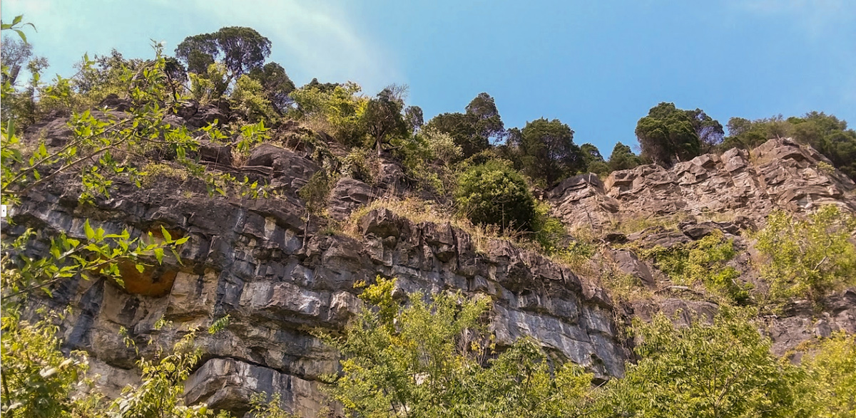
Photo by Jacob Wheeler, August 2019.
They dissolve to a kind of redish clay colord dust . . . . The foot of these rocks are 150 or 200 ft. above the water, and the space between composed of the broken rocks that have fallen from the mountain. The top of the perpindicular wall is not less than 400 ft. above the water in appearance.
—Thomas Rodney, 1 November 1803[3]Dwight L. Smith and Ray Swick, ed., A Journey Through the West: Thomas Rodney’s 1803 Journal from Delaware to the Mississippi Territory (Athens: Ohio University Press, 1997), 157.
A Mississippi Ritual
Moving up the Mississippi later this month, the expedition would pass another tower—namely, the Grand Tower:
Arrived at the Grand Tower a little before sunset, passed above it and came too on the Lard. shore for the night. This seems among the watermen of the mississippi to be what the tropics or Equanoxial line is with regard to the Sailors; those who have never passed it before are always compelled to pay or furnish some sperits to drink or be ducked
—Meriwether Lewis, 25 November 1803
Lewis’s Pleasing View
On the last reaches of the Missouri River in mid-July, Lewis would name his own tower rock:
at this place there is a large rock of 400 feet high wich stands immediately in the gap which the missouri makes on it’s passage from the mountains . . . . this rock I called the tower. it may be ascended with some difficulty nearly to it’s summit, and from it there is a most pleasing view of the country we are now about to leave.
—Meriwether Lewis, 16 July 1805
View from Tower Rock (Montana)
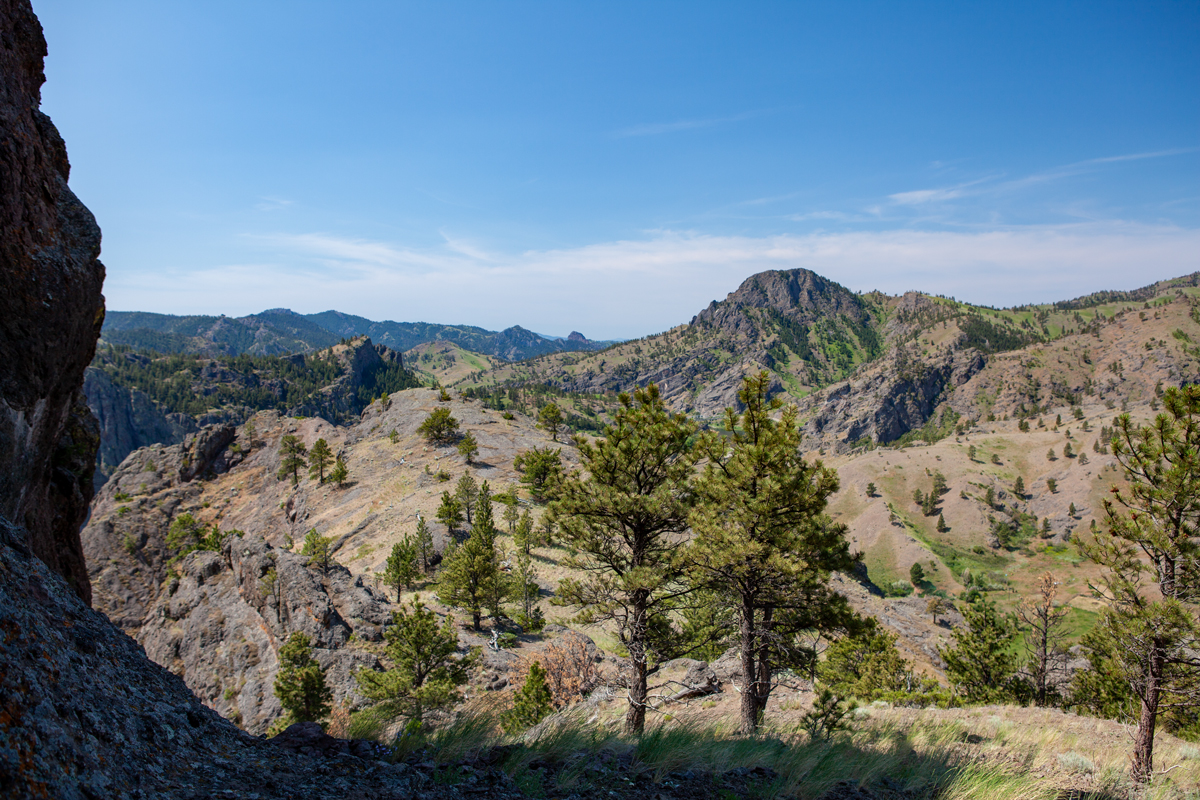
© 24 July 2013 by Kristopher K. Townsend. Permission to use granted under the Creative Commons Attribution-Share Alike 4.0 International license.
The view above is on a precipice near the top of Tower Rock, likely where Lewis stood to get a better view. The peak in the distance is Sugarloaf Mountain, a member of the Adel Mountain Volcanics. An old Missouri River channel cuts between the two. For more, see Tower Rock (Montana).
Navigational Challenges
In his journal, Rodney reminds us that the Ohio River here presented challenges to the navigator in 1803. After passing Hurricane Island opposite present Elizabethtown, Illinois, he encountered fog and got stuck on a sandbar.
Huricane Island is about 8 miles below the cave; and they told us at said island it was 35 miles from there to Cumberland River. About ten miles below Huricane is a large sand bar on the NW shore extending from a point on that shore where the river makes a short turn. The channel is on the Kentucky shore. We got on the bar in the fog, and turn back a little way and followed the current to Kentucky shore, and were round the bar when the fog rolld off.
—Thomas Rodney, November 1, 1803[4]Rodney, Journal, 156.
Experience the Lewis and Clark Trail
The Lewis and Clark Trail Experience—our sister site at lewisandclark.travel—connects the world to people and places on the Lewis and Clark Trail.
Plan a trip related to November 8, 1803:

Notes
| ↑1 | Neither captain appears to be keeping a journal as the expedition travels between Louisville and Fort Massac and their precise location on this date is unknown. |
|---|---|
| ↑2 | Fortescue Cuming, Sketches of a Tour to the Western Country: Through the States of Ohio and Kentucky, a voyage down the Ohio and Mississippi rivers, and a trip through the Mississippi territory, and part of West Florida, commenced at Philadelphia in the winter of 1807 . . . (Pittsburgh: Cramer, Spear, & Eichbaum, 1810). 249 |
| ↑3 | Dwight L. Smith and Ray Swick, ed., A Journey Through the West: Thomas Rodney’s 1803 Journal from Delaware to the Mississippi Territory (Athens: Ohio University Press, 1997), 157. |
| ↑4 | Rodney, Journal, 156. |