Late in the day, the expedition leaves Fort Massac and sets up camp on the opposite side of the Ohio—about three miles down the river. It begins to rain and Lewis is ‘seized with a violent ague’.
In Vincennes, Indiana Territorial Governor William Henry Harrison pens a letter to William Clark mentioning John Hay of Cahokia and including a map of the Missouri.
Fort Massac on the Ohio River
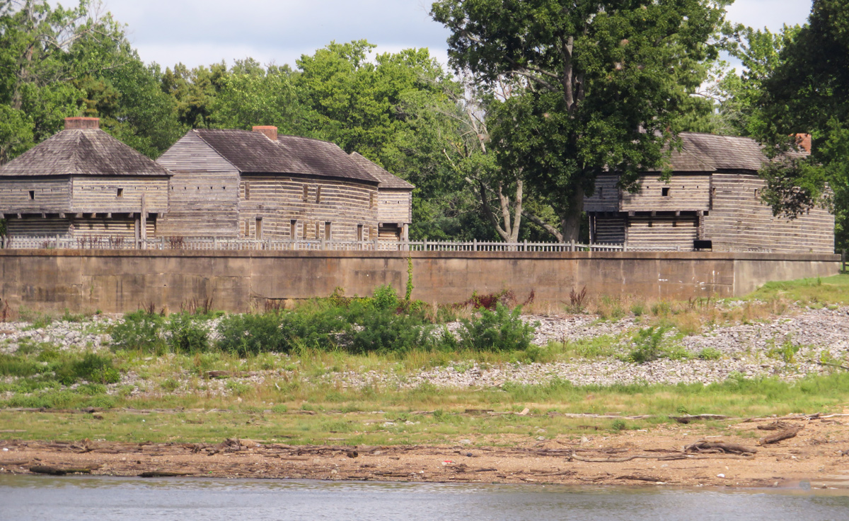
© 2021 by Robert Heacock. Used by permission.
Leaving Fort Massac
left Massac this evening about five oclock— descended about three miles and encamped on the S. E. shore
—Meriwether Lewis
With this entry, Clark appears to have started a field note on this day:
Left Fort Masacre [Massac] the 13th of Novr 1803 at 4 oClock with an at
—William Clark
Violent Ague
raind very hard in the eving and I was siezed with a violent ague which continued about four hours and as is usual was succeeded by a feever which however fortunately abated in some measure by sunrise the next morning,
—Meriwether Lewis
Ague [AY-gyou] is an intermittent fever alternating with chills. In the journals, it could refer to colds and flues, but most often, the term referred to malaria.[2]Alan H. Hartley, Lewis & Clark Lexicon of Discovery (Pullman, WA: WSU Press, 2004), 2. For more see Mosquito Ills and Cures and The Last Journey of Meriwether Lewis.
Governor Harrison’s Assistance
Vincennes 13th Nov. 1803
My Dear Sir [William Clark]
The map mentioned in your letter of the 5th Instant had been taken from me by Mr. Jones who claimed it as the property of Mr. Hay of Cahokia, but as it was still in the possession of Mr. Jones I have had it copied & now send it to you by the Post rider . . . .
Indian Office Map (detail)
Missouri River between the Little Missouri and James Rivers
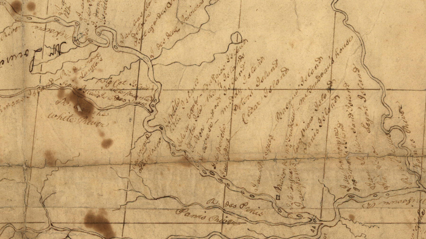
U.S. Library of Congress.[3]Finiels, Nicolas De, Meriwether Lewis, William Clark, William Henry Harrison, James Mackay, and John Evans. Map of Missouri River and vicinity from Saint Charles, Missouri, to Mandan villages of … Continue reading
Your offer to let me hear from you occasionally I accept with a great deal of pleasure—& I beg of you to let me Know from Cahokia whether I can do any thing for you in yr. absence.
. . . . .
Give my respects to Captn. Lewis & ask him to spend a few days with me on his return. I am your friend,
William H. Harrison[4]Letters of the Lewis and Clark Expedition with Related Documents: 1783–1854, ed. Donald Jackson (Urbana: University of Illinois Press, 1978), 135.
What has become known as the “Indian Office Map” (detail shown above) is generally thought to be the map sent by Governor Harrison. It was likely made by John Evans who traveled as far as the Mandan villages in present North Dakota. The map is extensively annotated by William Clark including English labels and information that he gained at Fort Mandan.[5]Moulton, Atlas, 6.
John Hay’s extensive experience with Native American Nations and the fur trade along the Missouri and Mississippi rivers proved invaluable to the expedition. He offered significant information and advice, particularly in procuring the appropriate types and quantities of gifts for the Native Americans.
Experience the Lewis and Clark Trail
The Lewis and Clark Trail Experience—our sister site at lewisandclark.travel—connects the world to people and places on the Lewis and Clark Trail.
Plan a trip related to November 13, 1803:
Notes
| ↑1 | James J. Holmberg, ed., Dear Brother: Letters of William Clark to Jonathan Clark (New Haven: Yale University Press, 2002), 66n8; Donald Jackson, Letters of the Lewis and Clark Expedition with Related Documents: 1783–1854, ed. Donald Jackson (Urbana: University of Illinois Press, 1978), 135–36n3; “Fort Massac”, Wikipedia, https://en.wikipedia.org/wiki/Fort_Massac. |
|---|---|
| ↑2 | Alan H. Hartley, Lewis & Clark Lexicon of Discovery (Pullman, WA: WSU Press, 2004), 2. |
| ↑3 | Finiels, Nicolas De, Meriwether Lewis, William Clark, William Henry Harrison, James Mackay, and John Evans. Map of Missouri River and vicinity from Saint Charles, Missouri, to Mandan villages of North Dakota: used by Meriwether Lewis and William Clark in their expedition up Missouri River. [1798] Map, www.loc.gov/item/2002621122/. |
| ↑4 | Letters of the Lewis and Clark Expedition with Related Documents: 1783–1854, ed. Donald Jackson (Urbana: University of Illinois Press, 1978), 135. |
| ↑5 | Moulton, Atlas, 6. |