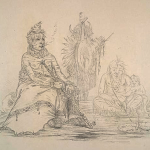
Pachtüwa-Chtä. An Arrikkara Warrior
Karl Bodmer (1809–1893)
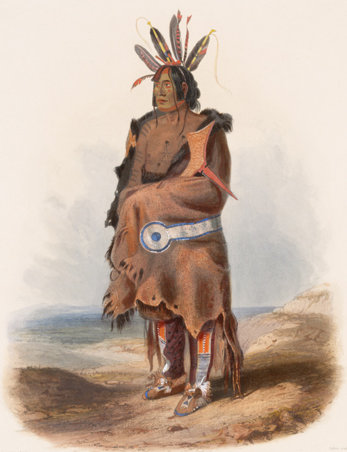
Rare Book Division, The New York Public Library.[1]“Pachtüwa-Chtä, Arrikkara Krieger. Pachtüwa-Chtä, Geurrier Arrikkara. Pachtüwa-Chtä, Arrikkara Warrior.” New York Public Library Digital Collections. Accessed March 9, 2019. … Continue reading
Spelled variously in the expedition journals—Rickerie, Recreries, Richarees, Ree, Ricare, Arickaree, Rick, Rics, and Star rah he—Clark sometimes called the Arikara people Pawnee due to their similar linguistic origins—both were Caddoan-speaking people. They are also known as Sahnish and Hundi.
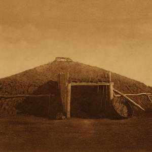
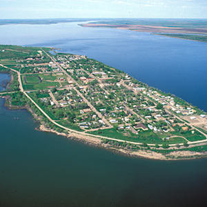
When they met the Lewis and Clark Expedition in early October 1804 at the village of Sawa-haini above present-day Mobridge, South Dakota, the Arikara were reduced to three villages. There, the captains met traders, Joseph Garreau, Pierre-Antoine Tabeau, and Joseph Gravelines. The latter would serve as interpreter and pilot the barge (called the ‘boat’ or ‘barge’ but never the ‘keelboat’) on its return to St. Louis in spring 1805. Arikara Chief Too Né, also known as Piahito or Eagle Feather, came on board as a diplomat in the captains’ efforts to bring peace between the Arikaras, Mandans, and Hidatsas. The chief agreed to travel to Washington City as an Arikara delegate, and his unfortunate death during that trip had a significant impact on American fur trade interests on the Missouri River and affect the lives of several expedition members.
Having lived a year with the Arikara, St. Louis-based trader Tabeau informed the captains about the people and later wrote a formal report not published for over a century. In it, he describes the people’s current decline:
Of the eighteen fairly large villages, situated upon the Missouri at some distance from each other, the Ricaras are reduced to three mediocre ones, the smallest of which is a league from the other two. They comprise in all about five hundred men bearing arms. Some hostile inroads but, in particular, the smallpox unexpectedly made this terrible ravage among them. These three villages are today composed of ten different tribes and of as many chiefs without counting an infinity of others who have remained, after the disaster, captains without companies.[2]Pierre-Antoine Tabeau, Tabeau’s Narrative of Loisel’s Expedition to the Upper Missouri River, Annie Heloise Abel, Ed., translated from French by Rose Abel Wright, (Norman: University of … Continue reading
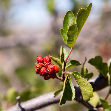
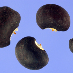
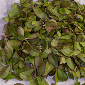
Prior to the smallpox epidemics of the late 18th-century, Arikara and Pawnee bands lived in present-day Nebraska and Kansas practicing the Central Plains Village tradition. Warfare and disease prompted bands of Arikara to move north and form larger villages. In addition to hunting, they grew corn, squash, beans, watermelon, sunflowers and native tobacco (Nicotiana quadrivalvis).[3]Douglas R. Parks, Handbook of North American Indians: Northeast Vol. 13, Plains, ed. Raymond J. DeMallie (Washington, D.C.: Smithsonian Institution, 2001), 368.
Tabeau’s narrative elaborated on frequent and violent infighting among the Arikara survivors. He also stated rather bluntly, “[T]he Ricaras are the most simple and the most stupid of all the Savages of the Upper Missouri.”[4]Tabeau, 131–32. The captains’ “Estimate of the Eastern Indians” was more generous of the people and emphasized their role as victims at the hands of the Sioux:
The Tetons [Lakota Sioux] claim the country around them. Though they are the oldest inhabitants, they may properly be considered the farmers or tenants at will of that lawless, savage and rapacious race the Sioux Teton, who rob them of their horses, plunder their gardens and fields, and sometimes murder them, without opposition. If these people were freed from the oppression of the Tetons, their trade would increase rapidly, and might be extended to a considerable amount. They maintain a partial trade with their oppressors the Tetons, to whom they barter horses, mules, corn, beans, and a species of tobacco which they cultivate; and receive in return guns, ammunition, kettles, axes, and other articles which the Tetons obtain from the Yanktons of the N. and Sissatones, who trade with Mr. Cammeron, on the river St. Peters [Des Moines].[5]Moulton, Journals, 3:400–01.
Both Tabeau and the captains were of the mind that the Arikara were ready to ally with the Mandan, a move that favored American trade interests in the region. Too Né, chief of the Waho-erha band traveled with the expedition to the Knife River Villages where they smoked the pipe of peace with the Hidatsas and Mandans. In April 1805, the expedition left the Knife River with news of an Arikara band wanting the move there, and Too Né traveled in the barge to St. Louis. His delegation would continue to Washington City where he met Thomas Jefferson, Senator Samuel Latham Mitchill, and made a map of his Arikara world.[6]Too Né’s map is featured in We Proceeded On, May 2018, available at https://lewisandclark.org/wpo/pdf/vol44no2.pdf.
Too Né would die during the trip, and Tabeau’s and the Captains’ expectations would not be met for several decades. In fact, in the two decades after the expedition, the Arikara were a fierce obstacle to American expansion in the upper Missouri River. In 1807, the Arikara successfully prevented the return of Mandan Chief Sheheke from his Washington City journey. Nathaniel Pryor, a sergeant in the Lewis and Clark Expedition, would lead an armed force to get the Sheheke and his retinue past the Arikara. That attempt failed, and expedition alumni George Shannon and George Gibson would both be wounded. Some suggest the failed attempts to return Sheheke to his home was a contributing factor in the suicide of Meriwether Lewis.[7]See “Lewis’s Ultimate Failure” in Sheheke’s Delegation. See also The Last Journey of Meriwether Lewis by Clay S. Jenkinson.
Sheheke was eventually returned, only to be killed later by some Arikara, and the people continued to hamper American traders trying to get past their villages on the Missouri River. In 1823, former member John Collins was one of several men killed by the Arikara during a battle with William Henry Ashley’s fur trade party.[8]See also “Ashley and Henry” in Post-expedition Fur Trade by W. Raymond Wood. That skirmish resulted in a punitive campaign of 250 U.S. Army and 750 Sioux soldiers led by Colonel Henry Leavenworth. After several days of shelling, the Arikara escaped by night seeking sanctuary in Mandan and Hidatsa villages.[9]Parks, 367.
In 1862, decimated by disease, wars, and treaties, the Arikara fully allied with the Mandans and Hidatsas moving to the Fort Berthold Reservation, a remnant of the traditional Hidatsa territory at the time of the expedition. The alliance is known today as The Three Affiliated Tribes or the Mandan, Hidatsa, and Arikara Nation.
Selected Pages and Encounters
Assessing the Legacy of Lewis and Clark
by Clay S. Jenkinson
The author proposes a few metaphors for the Lewis and Clark story, not in any definitive way, but merely to help us all think about the legacy of the expedition.
Too Né’s Delegation
by Joseph A. Mussulman
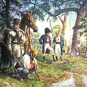
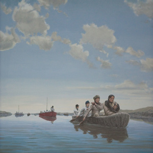
A delegation of chiefs from the Arikara, Ponca, Omaha, Otoe, Iowa, and Missouria nations sailed down the Missouri with Corporal Warfington on the expedition’s keelboat in the spring of 1805. Early in January, 1806, President Jefferson greeted them in Washington City with a formal speech.
Joseph Gravelines
by Clay S. Jenkinson
The Arikara-resident trader and interpreter Gravelines proved to be so reliable and so good at the immediate tasks put to him that long after the Lewis and Clark Expedition he was employed by the United States government to represent its interests among the Arikara.
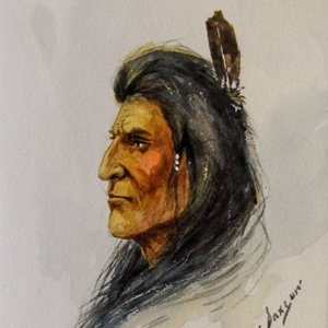
Too Né (Eagle Feather)
Arikara guide and diplomat
by Clay S. Jenkinson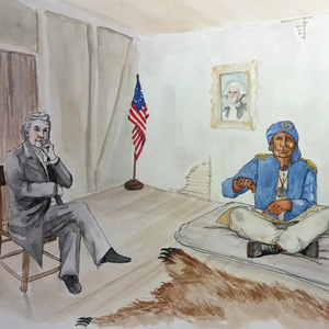
This Arikara leader rode upriver with the expedition in the weeks that followed to negotiate a peace settlement with the Mandan. In the spring of 1805 he went down river with the barge to St. Louis. After a series of delays, he went to Washington, DC, to meet with President Jefferson.
Meet the Three Affiliated Tribes
Interviews with tribal members
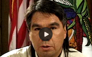
My name is Tex Hall. I’m the tribal chairman of the Three Affiliated Tribes . . . the Mandan, Hidatsa and Arikara Nation . . . here at Fort Berthold at present day New Town, North Dakota. I would like to speak a little Hidatsa because I am Mandan and Hidatsa.
Hidatsa Territory
Becoming the Fort Berthold Reservation
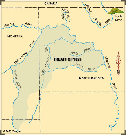
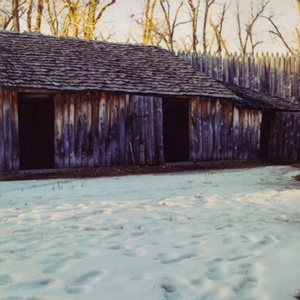
After leaving Fort Mandan on 7 April 1805, the expedition traveled for several days through Hidatsa territory. Much of that area would become the Fort Berthold Reservation of the Three Affiliated Tribes, a coalition of Hidatsa, Mandan, and Arikara.
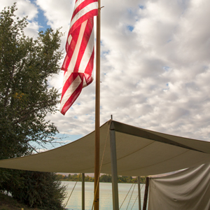
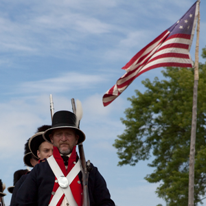
Flag Presentations
by Joseph A. Mussulman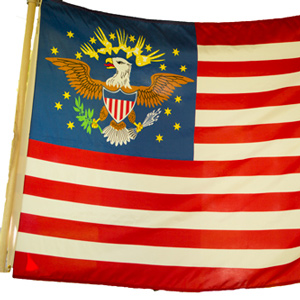
Lewis and Clark usually distributed flags at councils with the chiefs and headmen of the tribes they encountered—one flag for each tribe or independent band.
October 1, 1804
The Cheyenne River
At the Cheyenne River, the captains meet trader Jean Vallé who tells them about that river. Clark finds that buffaberries make a delightful tart, and Lewis adds three specimens to his plant collection.
October 4, 1804
Turn around
The day begins by dropping back three miles to a better channel. They avoid the Sioux along the banks, and camp across from an abandoned Arikara village near present Forest City, South Dakota.
October 6, 1804
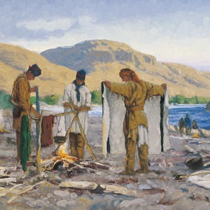
Empty Arikara village
The expedition comes to a recently inhabited Arikara village. Walking the shore, Lewis observes several types of birds while the boats struggle to navigate the numerous Missouri River channels.
October 7, 1804
Grizzly bear tracks
At the mouth of the Moreau, the travelers encounter their first grizzly bear tracks. They also see an empty Arikara village. Below present Mobridge, South Dakota, they camp by an island with many grouse.
October 8, 1804
Arikara village Sawa-haini
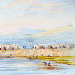
Near present Mobridge, South Dakota, Pvt. Frazer is promoted to the permanent party and assigned to Sgt. Gass. Camp is near Sawa-haini—an Arikara village where the interpreter Joseph Gravelines is found.
October 9, 1804
York's big medicine
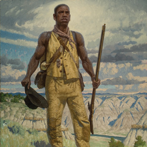
At Sawa-haini—an Arikara village near Mobridge, South Dakota—the planned council is delayed by weather. York fascinates the Arikara who apparently have never seen a black man before.
October 10, 1804
An Arikara council
At Sawa-haini above present Mobridge, South Dakota, a council with the Arikaras is held. The standard speeches and gifts are given, Lewis demonstrates his air gun, and York hams it up for the locals.
October 11, 1804
Arikara council
In a council, Arikara chiefs promise to keep the Missouri river open to trade with the United States. At another village near present Rogo Bay, South Dakota, the impoverished villagers give gifts of food.
October 12, 1804
Trading with the Arikara
At an Arikara village, the morning is spent parleying and trading. At 1 pm, the expedition heads up the Missouri River and encamps near present Shaw Creek Recreation Area in South Dakota.
October 13, 1804
Newman's court-martial
Private John Newman is tried for making mutinous remarks, and he is removed from the “permanent party engaged for North Western discovery”. Clark learns of an Arikara legend about some unusual rocks.
October 14, 1804
Pvt. Newman's punishment
The day is rainy and most of the leaves have fallen as the expedition enters present North Dakota. The execution of Pvt. Newman’s court martial sentence startles chief Too Né who is traveling with them.
October 15, 1804
Arikara exchanges
As the expedition travels near present Fort Yates, North Dakota, they pass various Arikara hunting camps. A young Indian girl travels with the boats, and York is “the Greatest Curiousity to them”.
Fort Yates
Hunting party
by Joseph A. Mussulman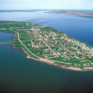
The Corps observed an Indian strategy for hunting game. As men on horseback herded pronghorns—”goats or Antelope,” Clark called them—into the river, boys swam among them and killed some with sticks, while others on shore shot them with bows and arrows.
October 16, 1804
"Goat" hunting
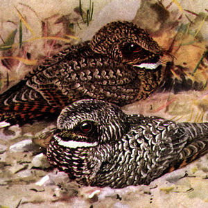
The expedition struggles 14 river miles between present Fort Yates and Beaver Creek in North Dakota. Some Arikaras hunt pronghorn, and Lewis adds common poorwill and creeping juniper to his collection.
October 17, 1804
Too Né tells stories
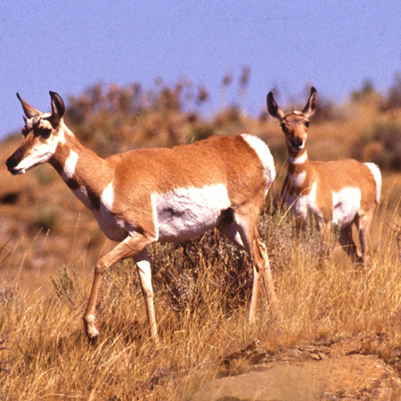
The barge is towed six miles against a headwind before the expedition stops for the day below the Cannonball River. Clark learns that pronghorns swim the river in a twice-yearly migration.
October 24, 1804
Mandan cordiality
The morning brings snow and rain. Near present Washburn, North Dakota, the captains and Arikara chief Too Né are greeted by a Mandan chief and with great cordiality and ceremony, smoke the pipe.
October 29, 1804
Mandan and Hidatsa council
Opposite the Knife River, Mandan and Hidatsa chiefs come from each village to council with the captains. A long speech is given, and the captains ask them to smoke the pipe of peace with an Arikara chief.
November 10, 1804
Hewing and guttering
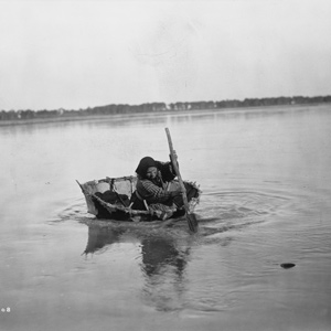
At Fort Mandan, cottonwood logs are shaped with axes and adzes so that they can be used to cover cabin roofs. A Mandan-Arikara man and his wife cross the river in a bull boat with a load of buffalo meat.
November 20, 1804
Sioux threats
At Fort Mandan below the Knife River Villages, Charbonneau brings in a large load of meat and furs, and the captains move into their quarters. Three chiefs from Ruptáre bring news of a Sioux threat.
December 1, 1804
Hudson's Bay Company visitor
![]()
Trader George Henderson of the Hudson’s Bay Company visits Fort Mandan, and Sgt. Ordway describes their business at the Knife River villages. A delegation of Cheyennes and Arikaras arouse Mandan suspicion.
December 2, 1804
A Cheyenne delegation
When four Cheyennes arrive at Fort Mandan, the captains give them a speech, tobacco, a flag, and demonstrations of many ‘curiosities’. They also give them a letter of warning for the Sioux and Arikaras.
February 22, 1805
Fort Mandan rain
The residents of Fort Mandan receive their first rain since last November. Lewis and his recently returned hunters rest while the other enlisted men work to free the boats from the river’s snow and ice.
February 28, 1805
Arikara and Sioux news
Traders arrive at the Knife River Villages with news and two plant specimens for Lewis. About six miles from Fort Mandan, several enlisted men cut down cottonwood trees to make dugout canoes.
March 16, 1805
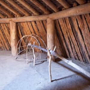
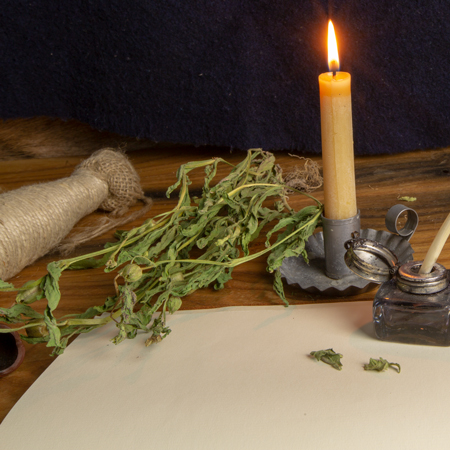
Arikara bead-making
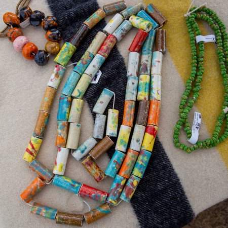
At Fort Mandan, trader Joseph Garreau shows the captains how the Arikara melt glass trade beads and then re-make them more to their liking. Pvt. Whitehouse strikes an Indian with his spoon.
April 6, 1805
A diplomatic delay
Some visiting Mandans tell the captains that the entire Arikara nation has moved to one of their old villages nearby. The captains postpone leaving Fort Mandan to learn more.
April 7, 1805
Leaving Fort Mandan
The permanent party leaves Fort Mandan bound for the Pacific Ocean. They make it only as far as Mitutanka, one of the Knife River Villages. In the barge, the return party heads towards St. Louis.
October 8, 1805
A canoe accident
On the Clearwater River, the paddlers navigate numerous rapids and pick up guides Twisted Hair and Tetoharsky. After a canoe accident at Colter’s Creek—present Potlatch River—travel abruptly stops.
August 11, 1806
Cruzatte shoots Lewis
Lewis is shot through the buttock. An Indian attack is suspected, but likely Pvt. Cruzatte mistook him for an elk. Clark meets fur traders who share news of the barge, the fur trade, and Indian wars.
August 21, 1806
At the Arikara villages
At the Arikara villages above present Mobridge, South Dakota, several councils are conducted between various Mandans, Arikaras, and Cheyennes. One of their 1804 engagés shares ominous news.
August 25, 1806
Empty Lakota encampment
On their return down the Missouri, they pass an empty Lakota encampment and recall the “Troubleson Tetons” experienced on their way up the river in 1804. They camp above present Pierre, South Dakota.
Notes
| ↑1 | “Pachtüwa-Chtä, Arrikkara Krieger. Pachtüwa-Chtä, Geurrier Arrikkara. Pachtüwa-Chtä, Arrikkara Warrior.” New York Public Library Digital Collections. Accessed March 9, 2019. http://digitalcollections.nypl.org/items/510d47da-c40f-a3d9-e040-e00a18064a99. |
|---|---|
| ↑2 | Pierre-Antoine Tabeau, Tabeau’s Narrative of Loisel’s Expedition to the Upper Missouri River, Annie Heloise Abel, Ed., translated from French by Rose Abel Wright, (Norman: University of Oklahoma Press, 1939), 123-125. |
| ↑3 | Douglas R. Parks, Handbook of North American Indians: Northeast Vol. 13, Plains, ed. Raymond J. DeMallie (Washington, D.C.: Smithsonian Institution, 2001), 368. |
| ↑4 | Tabeau, 131–32. |
| ↑5 | Moulton, Journals, 3:400–01. |
| ↑6 | Too Né’s map is featured in We Proceeded On, May 2018, available at https://lewisandclark.org/wpo/pdf/vol44no2.pdf. |
| ↑7 | See “Lewis’s Ultimate Failure” in Sheheke’s Delegation. See also The Last Journey of Meriwether Lewis by Clay S. Jenkinson. |
| ↑8 | See also “Ashley and Henry” in Post-expedition Fur Trade by W. Raymond Wood. |
| ↑9 | Parks, 367. |
Experience the Lewis and Clark Trail
The Lewis and Clark Trail Experience—our sister site at lewisandclark.travel—connects the world to people and places on the Lewis and Clark Trail.
![]()
Discover More
- The Lewis and Clark Expedition: Day by Day by Gary E. Moulton (University of Nebraska Press, 2018). The story in prose, 14 May 1804–23 September 1806.
- The Lewis and Clark Journals: An American Epic of Discovery (abridged) by Gary E. Moulton (University of Nebraska Press, 2003). Selected journal excerpts, 14 May 1804–23 September 1806.
- The Lewis and Clark Journals. by Gary E. Moulton (University of Nebraska Press, 1983–2001). The complete story in 13 volumes.
This site is provided as a public service by the![]()
Lewis and Clark Trail Alliance
with cooperation and funding from the following organizations:
- Lewis and Clark National Historic Trail
- Montana Committee for the Humanities
- Idaho Governor's Lewis and Clark Trail Committee
- The Capital Gallery (Lewis and Clark Fort Mandan Foundation)
- Yellowstone Public Radio
Unless otherwise noted, journal excerpts are from The Journals of the Lewis and Clark Expedition, edited by Gary E. Moulton, 13 vols. (Lincoln: University of Nebraska Press, 1983-2001).