“Camp of the Gros Ventres of the prairies on the upper Missouri” c. 1840
Karl Bodmer (1809–1893)
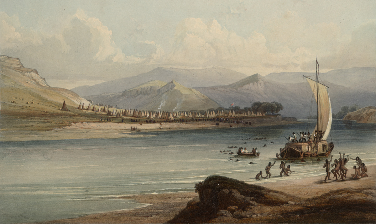
Courtesy Rare Book Division, The New York Public Library.[1]“Lager der Gros Ventres des prairies am obern Missouri. Camp des Gros Ventres des prairies sur le Missouri. Camp of the Gros Ventres of the prairies on the upper Missouri.” New York … Continue reading
When the expedition passed the above place in the Upper Missouri River Breaks, they only saw signs of the Atsina People. Imagine how the Expedition may have been different had the site been occupied when they arrived on 30 May 1805.
In 1772, Hudson’s Bay employee Mathew Cocking met the Atsina at the forks of the Saskatchewan and called them the Waterfall Indians. The captains, in their “Estimate of the Eastern Indians,” identify these people as the “Falls Indians.” Today, they are known as the Atsina or Gros Ventre, but their names in the historical literature—Big Bellies, Gros Ventre and Minnetares—cause confusion even to this day. These names are given to two very different tribes, the Hidatsa of the northern plains, and the Atsina of north central Montana and Saskatchewan. The terms “Gros Ventres of the Prairie” (Atsina) and “Gros Ventres of the Missouri” was adopted in the 19th century to avoid confusion.
On 28 May 1805 Clark calls them “Minetaries of Fort de Prarie.” Patrick Gass begins his 28 July 1806 re-telling of Lewis’s fight on the Two Medicine by calling the young thieves “Prairie Grossventres.” In fact, the expedition never did meet any Atsina People. The boys were Blackfeet, close allies with the Atsina.[2]For the dangers of this portion of the expedition, see The Marias River Risk. Perhaps the lack of Atsina presence on the Lewis and Clark route was due to smallpox epidemics in 1780 and 1801.[3]Loretta Fowler and Regina Flannery, Handbook of North American Indians: Plains Vol. 15, Raymond J. DeMallie, Ed. (Washington, D.C.: Smithsonian Institute, 1978), 677–67.
The presence of the Atsina did, however, have a profound effect on the way several tribes interacted with the expedition. The British traded arms with the Blackfeet, Atsinas, and Assiniboines giving those people an advantage over their southern neighbors, the Nez Perce, Salish, and Lemhi Shoshone had difficulty obtaining Trade Guns. Neither could the disadvantaged tribes obtain arms from the Spanish who refused on policy. When asked for weapons, the captains could only give the Nez Perce, Salish, and Lemhi Shohone little more than promises and assurances.
Much of the poverty the captains witnessed while among the Lemhi Shoshone were due to recent raids by the Atsina. When Lewis met Cameahwait on 13 August 1805, they smoked a pipe in the only leather lodge they had. The rest had been stolen in an Atsina raid:
these people had been attacked by the Minetares of Fort de prarie this spring and about 20 of them killed and taken prisoners. on this occasion they lost a great part of their horses and all their lodges except that which they had erected for our accomodation; they were now living in lodges of a conic figure made of willow brush
—Meriwether Lewis
On the return trip, Lewis had to cross the Continental Divide without Nez Perce guides. They would not accompany him on the Road to the Buffalo that crosses present-day Lewis and Clark Pass. As Lewis described it, the “Nez Perce refused to continue for fear of the ‘Pahkees.’ Pahkee is likely from the Shoshone /pakihï’ï/ meaning rawhide armor, a reference to the tribe’s enemies: the Blackfeet, Atsina, Arapahoe, and Assiniboine.[4]Moulton, Journals, 8:90n9; William Bright, A Glossary of Native American Toponyms and Ethnonyms from the Lewis and Clark Journals, University of Colorado, accessed on 28 April 2020, … Continue reading
Today, the Atsina identify as Gros Ventre, but are also known as Aaniiih, A’aninin, Haaninin, and White Clay. Many are members of the Fort Belknap Indian Community, a federally recognized tribe from Montana that also includes Assiniboine People.[5]“Gros Ventre,” Wikipedia accessed on 24 November 2020, https://en.wikipedia.org/wiki/Gros_Ventre.
Selected Encounters
May 28, 1805
Judith River oasis
by Kristopher K. Townsend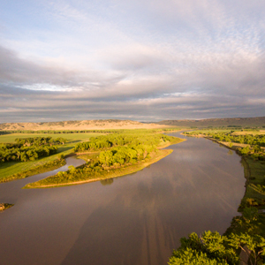
The enlisted men tow the boats twenty miles to reach the fertile Judith River Basin. Lewis finds the change in scenery reviving. Several Native American items are found floating down the river, and they worry the owners are not far ahead.
In St. Louis, military commander James Bruff proposes a mission for the expedition’s old barge.
May 30, 1805
The White Cliffs
by Kristopher K. Townsend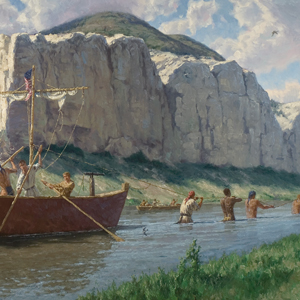
In the White Cliffs of the Upper Missouri River Breaks, the enlisted men struggle to tow the boats from slippery and narrow banks. Lewis tests the humidity by measuring the evaporation rate, and Pvt. Whitehouse describes an empty Atsina camp.
June 23, 1806
Three Nez Perce guides
by Kristopher K. Townsend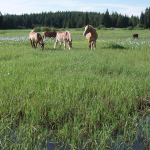
While waiting at Weippe Prairie for the mountain snow to melt, the hunters imitate bleating fawns to call in the does. Three Nez Perce guides arrive, and everything is made ready to cross the Bitterroot Mountains. Clark hears news of peace between the Walla Wallas and Shoshones and of war between the Atsinas and the Shoshones and Interior Salish.
July 4, 1806
Dangerous roads
by Kristopher K. Townsend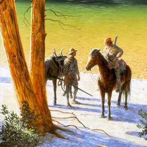
The expedition is divided into two groups, and today, both are on dangerous roads.
On the Blackfoot River, Lewis’s Nez Perce guides warn him about dangerous Indians, and they decline to continue. He travels east on “Cokahlahishkit”—the Road to the Buffalo—for eight miles. He also collects a specimen of mock orange, a species named in his honor.
On the Bitterroot River, Clark’s group must cross several creeks swollen from snows melting in the nearby Bitterroot Mountains. Despite there being no buffalo, whiskey, or tobacco, they celebrate the Fourth of July with a “Sumptious Dinner”.
July 17, 1806
Signs of danger
by Kristopher K. Townsend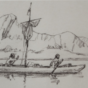
The expedition is split into four detachments separated by over 200 miles. On the plains north of the Great Falls of the Missouri, Lewis and his small group see a wounded bison, a sign that Indian hunters may be near.
On the Yellowstone River, Clark and his group scout for timber to make dugouts and see an “Indian fort” used by traveling war parties. He camps near present Reed Point, Montana.
Sgt. Ordway leads the paddlers down the Missouri navigating Pine Tree Rapids and passing Tower Rock. At the White Bear Islands, Sgt. Gass and his detail wait for the arrival of Ordway and the canoes.
August 3, 1806
Clark reaches the Missouri
by Kristopher K. Townsend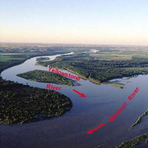
Reaching the mouth of the Yellowstone, Clark and his group stop to dry everything at their old camp of 26 April 1805. The mosquitoes are so thick that Clark cannot shoot accurately, yet he recommends the site for a fur trade post.
Many miles up the Missouri, Lewis and his group paddle seventy miles. To devote more time to paddling, he orders each mess to cook all they need for the next day. The hunting is good with 29 deer killed since yesterday morning.
Still on the Yellowstone, Sgt. Pryor and his group of three must navigate their small bull boats around the many bison crossing the river.
Notes
| ↑1 | “Lager der Gros Ventres des prairies am obern Missouri. Camp des Gros Ventres des prairies sur le Missouri. Camp of the Gros Ventres of the prairies on the upper Missouri.” New York Public Library Digital Collections. Accessed 22 December 2020. https://digitalcollections.nypl.org/items/510d47da-c45e-a3d9-e040-e00a18064a99. |
|---|---|
| ↑2 | For the dangers of this portion of the expedition, see The Marias River Risk. |
| ↑3 | Loretta Fowler and Regina Flannery, Handbook of North American Indians: Plains Vol. 15, Raymond J. DeMallie, Ed. (Washington, D.C.: Smithsonian Institute, 1978), 677–67. |
| ↑4 | Moulton, Journals, 8:90n9; William Bright, A Glossary of Native American Toponyms and Ethnonyms from the Lewis and Clark Journals, University of Colorado, accessed on 28 April 2020, https://lewisandclarkjournals.unl.edu/item/lc.sup.bright.01. |
| ↑5 | “Gros Ventre,” Wikipedia accessed on 24 November 2020, https://en.wikipedia.org/wiki/Gros_Ventre. |
Experience the Lewis and Clark Trail
The Lewis and Clark Trail Experience—our sister site at lewisandclark.travel—connects the world to people and places on the Lewis and Clark Trail.
Discover More
- The Lewis and Clark Expedition: Day by Day by Gary E. Moulton (University of Nebraska Press, 2018). The story in prose, 14 May 1804–23 September 1806.
- The Lewis and Clark Journals: An American Epic of Discovery (abridged) by Gary E. Moulton (University of Nebraska Press, 2003). Selected journal excerpts, 14 May 1804–23 September 1806.
- The Lewis and Clark Journals. by Gary E. Moulton (University of Nebraska Press, 1983–2001). The complete story in 13 volumes.
This site is provided as a public service by the
Lewis and Clark Trail Alliance
with additional funding from the following: