The expedition travels about thirteen miles up the Mississippi camping opposite present Chester, Illinois. Lewis describes the range of hills forming Cinque Hommes Cape and reports three grist mills and several settlers living in the area.
Brazeau Creek
Set out this morning before sunrise— (1) ¾ of a mile to the mouth of this river it is about 18 yards wide at it’s mouth and affords but little water at this moment, tho’ I am informed that there is a handsome settlement on it & that in high water it navigable many miles, it heads with the waters of the Saline of Mississippi & the St. Francis rivers—
N. 70 W. 1— —¾ To river Ameat Lard. qtr (1)
—Meriwether Lewis
Today, the mouth of Brazeau is about ¾ of a mile and 70° west of north of Devils Bake Oven, similar to “Ameat” recorded by Lewis in his courses and distances. Today it forms the Port of Wittenberg.
Up the Mississippi
Watercolor by Steve Ludeman
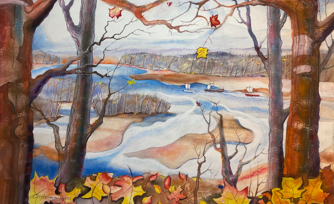
© 2023 by Steve Ludeman, www.steveludemanfineart.com. Used by permission.
Above: the three vessels under sail, ascending the Mississippi River. At this point in their journey, to accompany their barge, the Lewis and Clark Expedition had acquired two pirogue vessels: one white and one red. I did this painting on a beautiful September day, at a scenic overlook next to Fort Kaskaskia, Illinois. On November 28, 1803, they arrived at the Fort with about 24 men.—Steve Ludeman
A Bold Point of Rocks
This is a bold point of rocks forming the extremity of a range of hills which have continued on our Lard quarter for a considerable distance the Creek of the same name which puts in just above it is 20 miles in length and has a considerable number of inhabitants on it, and as many as three gristmills.—
—Meriwether Lewis
Meridian Altitudes
(3) at the lower point of this Ild. I came too and took Meridian Altitudes of
‘s L. L.; found it 62° 54′ 30″ Error of Sextant 8’ 45″—
—Meriwether Lewis
Of all the celestial observations the captains took, the simplest was to calculate latitude from a Meridian Altitude—a noon observation of the sun. They only needed a sextant or octant and a nautical almanac. Unlike longitude, an accurate clock was not necessary. For more on the procedure, see “Latitude” in Kansas River Observations by Robert N. Bergantino.
Experience the Lewis and Clark Trail
The Lewis and Clark Trail Experience—our sister site at lewisandclark.travel—connects the world to people and places on the Lewis and Clark Trail.
This page was funded in part by the Lewis and Clark National Historic Trail, U.S. National Park Service.
Discover More
- The Lewis and Clark Expedition: Day by Day by Gary E. Moulton (University of Nebraska Press, 2018). The story in prose, 14 May 1804–23 September 1806.
- The Lewis and Clark Journals: An American Epic of Discovery (abridged) by Gary E. Moulton (University of Nebraska Press, 2003). Selected journal excerpts, 14 May 1804–23 September 1806.
- The Lewis and Clark Journals. by Gary E. Moulton (University of Nebraska Press, 1983–2001). The complete story in 13 volumes.
This site is provided as a public service by the

Lewis and Clark Trail Alliance
with additional funding from the following: