Lewis likely reaches the Monongahela River at present Brownsville, Pennsylvania—called Redstone Old Fort in 1803. On the Cumberland Road, he would have passed Uniontown and Fort Necessity where George Washington surrendered to French and Indian forces in 1754.
Traveling the same road one month prior to Lewis, Thaddeus Harris described the journey.
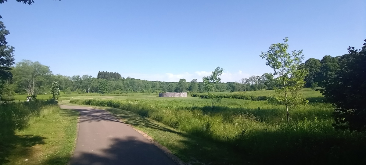
Fort Necessity (Reconstruction)
Courtesy Fort Necessity National Battlefield, U.S. National Park Service.
At the Battle of Fort Necessity on 3 July 1754, Colonel George Washington surrendered his British colonial forces to the French and Indians. He would save his reputation a year later at the Battle of Monongahela, also known as Braddock’s defeat. Just east of Uniointown, breastworks could still be seen when Lewis passed on his way to Pittsburgh.
Uniontown
Monday, June 13 [1803]
Uniontown is the shire town of the County. It is a very pleasant and thriving place, situated near Redstone Creek, and principally built upon one straight street, the side walks of which are neatly paved with large fiat stones. It contains about one hundred and twenty houses, many of them well built, and some quite handsome. The public buildings are a meeting-house, and a stone Gaol. There is a printing-office in the town which issues a weekly news-paper. Several manufactures are carried on in the place, and much business done in the Mercantile line to very great advantage. Though the town has been settled but fifteen years, it is, next to Pittsburgh and Wheeling, the most flourishing town through which we passed on the western side of the mountains. Near it are some valuable merchant-mills; and in the county are eighteen furnaces and iron works, and several distilleries.
—Thaddeus Harris[1]Thaddeus Harris, The Journal of a Tour into the Territory Northwest of the Alleghany Mountains Made in the Spring of the Year 1803, p. 66 in Reuben G. Thwaites, Travels West of the Alleghanies … Continue reading
Brownsville (Redstone Old Fort)
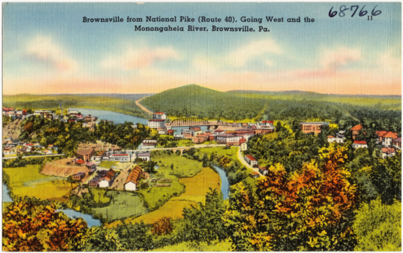
Monongahela River, Brownsville, Pa.
Postcard from the Tichnor Brothers Collection of the Boston Public Library, downloaded from Digital Commonwealth, Massachusetts Collections Online, www.digitalcommonwealth.org/search/commonwealth:4m90f161g.
The above postcard mentions the “National Pike” better known as the National Road. When Lewis traveled from Harpers Ferry to Pittsburgh, the road went from Cumberland to Wheeling. It was first known as Chief Nemacolin’s Path, and subsequently Braddock Road, Cumberland Highway, and several other names.
SATURDAY, June 11
PASS through Washington and arrived at BROWNSVILLE to spend the Sabbath. The remarks I made upon the situation of this place have been transferred to the preceding account of the settlements on the Monongahela river.
Brownsville, formerly called “Redstone old fort,” is a post-town, belonging to Fayette County in Pennsylvania. Though extremely pleasant, and commanding a most extensive and interesting prospect of the river, the creeks, and the fine country around, it seems rather disadvantageously situated on account of the steep declivity of the hill on which it is principally built. It contains about one hundred and fifty houses, and five hundred inhabitants. There is a Roman Catholic church here, and four Friends’ meeting-houses in the vicinity.
An extensive paper-mill on Redstone Creek, a ropewalk, a brewery, several valuable manufactories, and within a few miles of the town twenty-four saw, grist, oil, and fulling mills, render this a place of much business. The trade and emigration down the river employ boat-builders very profitably. About one hundred boats of twenty tons each are said to be built here annually.
On the south side of Redstone Creek formerly stood Byrd’s Fort [Fort Burd].
—Thaddeus Harris[2]The Journal of a Tour, p. 33–34, 55 in Thwaites, Travels West of the Alleghanies, p. 337, 363
Brownsville History
Of Fort Burd and Brownsville, Thwaites offers:
As early as 1752, the Ohio Company had built a storehouse, called the “Hangard,” at the mouth of Redstone Creek . . . . After the capture of Fort Duquesne (1758), [General Henry] Bouquet sent Colonel James Burd to build a fort at this place, which was named Fort Burd; but it was long popularly known as Redstone Old Fort, because of the remains of moundbuilding Indians to be seen at this point. The fort was abandoned during Pontiac’s War (1763), but appears to have been garrisoned by the time of Lord Dunmore’s War (1774). It was the rendezvous for Clark’s [George Rogers Clark] men in 1778, and in 1791 the assembly place for fomenters of the Whiskey Rebellion. In 1785 the town of Brownsville was incorporated, and for many years continued to be an important starting point for Western emigration.[3]Thwaites, Travels West of the Alleghanies, p. 158–59n23
Experience the Lewis and Clark Trail
The Lewis and Clark Trail Experience—our sister site at lewisandclark.travel—connects the world to people and places on the Lewis and Clark Trail.
Plan a trip related to July 13, 1803:
- Harpers Ferry to Brownsville (Inspiration Trip)

Notes
| ↑1 | Thaddeus Harris, The Journal of a Tour into the Territory Northwest of the Alleghany Mountains Made in the Spring of the Year 1803, p. 66 in Reuben G. Thwaites, Travels West of the Alleghanies (Cleveland: The Arthur H. Clark Co., 1904), p. 363–64. |
|---|---|
| ↑2 | The Journal of a Tour, p. 33–34, 55 in Thwaites, Travels West of the Alleghanies, p. 337, 363 |
| ↑3 | Thwaites, Travels West of the Alleghanies, p. 158–59n23 |


