At Wood River across from the mouth of the Missouri, Sgt. Pryor takes letters from Clark to Lewis who is working in Cahokia.
In Washington City, President Jefferson writes a letter to Lewis and encloses a map of the Missouri River made by John Evans.
Letters for Lewis
Sent N Pryor with Letters &c. to Cap Lewis a[t] Kohokia the river rise, a fall of Snow last night, the Missouris is riseing and runs with Ice a Cloudy & warm day, I am better &c. a fine rain in the evening.
—William Clark
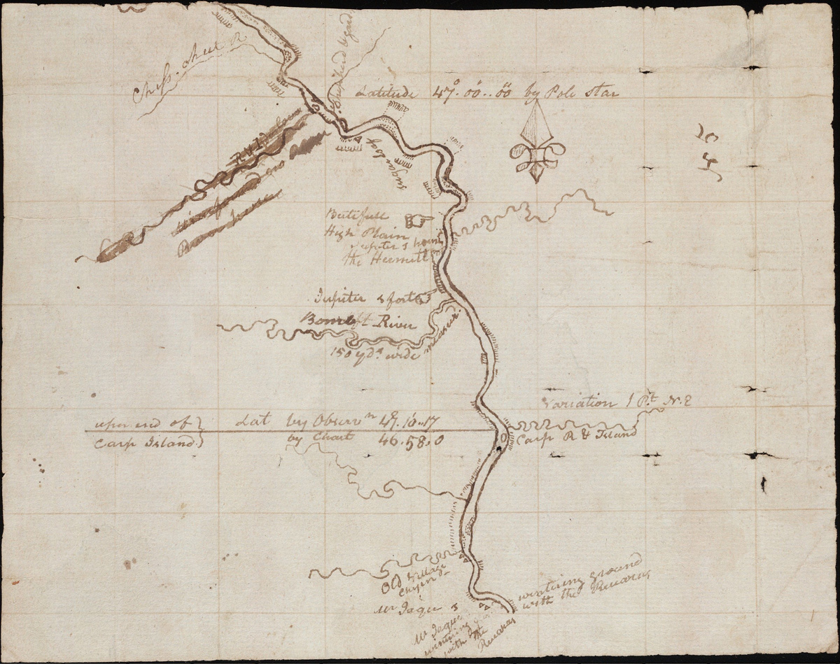
Evans Map Sheet 5
Digitized by Beinecke Rare Book and Manuscript Library, Yale University Library, brbl-dl.library.yale.edu/vufind/Record/3432429.
This map was likely carried by Lewis and Clark as they traveled up the Missouri River in 1804. Clark has written on nearly every sheet.[1]Moulton, Atlas, 6.
Mr. Evan’s Map
Washington Jan. 13. 1804.
Dear Sir
I now enclose you a map of the Missouri as far as the Mandans, 12. or 1500. miles I presume above it’s mouth. It is said to be very accurate, having been done by a Mr. Evans by order of the Spanish government. But whether he corrected by astronomical observations or not we are not informed.
TH: JEFFERSON[2]Jefferson to Lewis. Donald Jackson, Letters of the Lewis and Clark Expedition with Related Documents: 1783-1854, 2nd ed. (Urbana: University of Illinois Press, 1978), 163.
Weather Diary
Therm. at rise
weather wind Therm. at 4 oClock weather wind River cloudy & snow S W 0 rain & snow S W Snow’d last night
—Meriwether Lewis and William Clark[3]To assist the reader, the editor of this web page has omitted the date column, merged the “River” columns, and spelled out some abbreviations.
Experience the Lewis and Clark Trail
The Lewis and Clark Trail Experience—our sister site at lewisandclark.travel—connects the world to people and places on the Lewis and Clark Trail.
Plan a trip related to January 13, 1804:

Winter Camp at Wood River (Camp Dubois) is a High Potential Historic Site along the Lewis and Clark National Historic Trail managed by the U.S. National Park Service. The site, near Hartford, Illinois, is managed as Lewis and Clark State Historic Site and is open to the public.
Old Cahokia Courthouse is a High Potential Historic Site along the Lewis and Clark National Historic Trail managed by the U.S. National Park Service. The site is managed by the State of Illinois and is open to the public.
Notes
| ↑1 | Moulton, Atlas, 6. |
|---|---|
| ↑2 | Jefferson to Lewis. Donald Jackson, Letters of the Lewis and Clark Expedition with Related Documents: 1783-1854, 2nd ed. (Urbana: University of Illinois Press, 1978), 163. |
| ↑3 | To assist the reader, the editor of this web page has omitted the date column, merged the “River” columns, and spelled out some abbreviations. |


